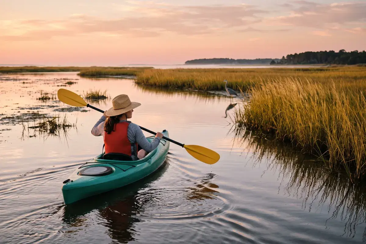
Most people paddle the Outer Banks by accident. They rent a kayak for an hour at whatever soundside stand is closest to their rental, loop around a bit of open water, and hand it back. It's fine. It is also nothing like what's actually available here.
The Outer Banks has a documented paddle-trail network — ten mapped blueway routes between Duck and Oregon Inlet, researched and published by The OBX Way, a local nonprofit, with a companion interactive map and photography of every access site. The routes are graded beginner, intermediate and advanced, and they run through canals, creeks, forest ponds and bays that you would never find by pulling into a parking lot and guessing.
This guide covers all ten, plus the public launches on the Currituck mainland side, plus the case for the paddle nobody markets to you: the one you take out your own back door at sunrise.
The Ten Mapped OBX Paddle Trails
The OBX Way documented public waterway access from Duck south to Oregon Inlet and published the results as the "Outer Banks Paddle Trails" essay and the OBX Paddle Map. Here's the full set, with the difficulty rating and route distance from the published trail data:
| Trail | Where | Difficulty | Route |
|---|---|---|---|
| Sandy Run Park | Kitty Hawk Woods | Beginner | 0.25 mi |
| Windgrass Circle | Kitty Hawk Bay | Beginner | 1.61 mi |
| Joe & Kay's Campground | Buzzard Bay | Beginner | 2.05 mi |
| Edward's Landing | Downtown Manteo | Beginner | 2.25 mi |
| Bob Perry Boat Ramp | Jean Guite Creek | Intermediate | 2.20 mi |
| Bowsertown Ditch | West Roanoke Island | Intermediate | 1.88 mi |
| NC Wildlife Avalon | Colington Creek | Intermediate | 1.61 mi |
| Crab Claw Spit | Ice Plant Island | Intermediate | 2.25 mi |
| Pineapple Beach | NW Roanoke Island | Advanced | 1.25 mi |
| Harvey Public Access | Roanoke Sound | Advanced | 3.11 mi |
A few of these deserve more than a table row.
Start Here If You've Never Paddled
Sandy Run Park (Kitty Hawk Woods) is the single best place on the Outer Banks to learn. It's a forest pond inside the Kitty Hawk Woods maritime forest, wind-protected on all sides, and the route is a quarter mile — which is exactly what you want when the goal is figuring out that a kayak doesn't tip over. Take a nervous kid or a nervous adult here first, then graduate them to open water.
Windgrass Circle (Kitty Hawk Bay) is the historical one. This is water the Wright brothers passed through hauling gear to Kill Devil Hills, and a living shoreline was installed along it in 2019 — the marsh grass and oyster structure you'll paddle past is doing real erosion-control work. Sheltered, scenic, easy.
Joe & Kay's Campground (Buzzard Bay) launches from the only tent campground on the northern Outer Banks, which makes it a natural pairing if anyone in your group is camping. Two miles of protected bay.
Edward's Landing (Downtown Manteo) is the one to do if you want a town at the end of it. You launch in downtown Manteo, travel south under the Cora Mae Bridge, and work through Shallowbag Bay into Scarboro Creek. Pair it with the Manteo waterfront — paddle in the morning, eat in town after.
Intermediate: Creeks, Canals, and Boat Traffic
The middle tier is where the Outer Banks paddling gets genuinely interesting, because you leave open water and get into the creek systems.
Bowsertown Ditch (West Roanoke Island) is a maze of creeks running under the Virginia Dare Memorial Bridge. Navigation matters here — bring the map, and don't assume you'll recognize the way you came.
Bob Perry Boat Ramp (Jean Guite Creek) takes you past an underpass mural and a covered bridge, which is not a sentence you expect to write about a barrier island. It's the most urban-feeling paddle on the list, in a good way.
NC Wildlife Avalon (Colington Creek) runs past residential boardwalks and docks. Watch the shallow straits — Colington's creeks get thin, and a loaded kayak finds bottom fast.
Crab Claw Spit (Ice Plant Island) uses the canal grid off Ice Plant Island and reaches the Banana Island sandbar, which is the payoff: a genuine sandbar destination you can beach on and stand up.
The Two Advanced Routes: Check the Wind First
Pineapple Beach (NW Roanoke Island) is short — 1.25 miles — and rated advanced anyway, because it's a highly exposed route with dock remnants in the water. The reward is the sightline: you're looking across at Jockey's Ridge from the water.
Harvey Public Access (Roanoke Sound) is the longest at 3.11 miles and comes with the bluntest caveat in the published trail data: only recommended under ideal conditions, with wind under 5 mph considered essential. Take that literally. Roanoke Sound is open, shallow, and builds chop faster than it looks like it should.
The Mainland Launches Nobody Lists
Every roundup of Outer Banks paddling assumes you're staying on the barrier islands. If you're based on the Currituck mainland — Grandy, Poplar Branch, Coinjock, Powells Point — you have your own access, and it's emptier.
Poplar Branch Boating Access Area (101 Poplar Branch Rd, Poplar Branch) is maintained by the NC Wildlife Resources Commission and has both a trailer ramp and dedicated canoe/kayak access, with universally accessible facilities. From US-158, turn onto NC-3 and follow it about 1.1 miles to the end of the road. This is the closest real public paddle launch to Grandy.
Coinjock (132 Coinjock Canal Road) is an NCWRC ramp on the Intracoastal Waterway with two launch lanes, courtesy docks, and trailer parking. It's a working ICW ramp, so expect powerboats and barge traffic — good for a canal paddle, not ideal for a beginner's first outing.
Worth knowing: the mainland side has almost no rental competition for launch space in July. On a changeover Saturday, when the beach-road kayak stands have a queue, Poplar Branch has a parking lot.
Paddling Currituck Sound from Your Own Launch
Here's the honest version of the pitch: the ten mapped trails are day trips. They're 20 minutes to an hour of driving from the Currituck mainland, plus loading and unloading boats, plus finding the access. They're worth doing — one or two of them, on purpose, on a day you've set aside.
The paddle you'll actually do every day is the one that requires no car at all.
Grandy Cove sits directly on Currituck Sound with a private dock and boat launch. That changes the math on paddling in a way that's easy to underrate until you've had it:
Sunrise paddles happen. The reason most vacation kayaking is mediocre is that it happens at 2pm, when the wind is up and the light is flat. Currituck Sound at 6:30am is glass. When the boat is thirty feet from where you slept, you go — no outfitter hours, no reservation, no drive. This is the difference between paddling once on your trip and paddling five times.
The water is forgiving. Most of Currituck Sound runs shallow with a soft bottom, and it's shielded from Atlantic swell by the barrier islands. That's why it works for kids, for nervous first-timers, and for anyone who wants to paddle without a plan. For full route detail — Monkey Island, Coinjock Bay, the northern open water — see our guide to kayaking Currituck Sound.
Kayak fishing is right there. A kayak gets you into the grass beds and shoreline structure that a trailered boat can't reach. Largemouth bass, crappie and bluegill hold along the vegetation edges. You can be on fish inside ten minutes of pushing off, and you can be back on the dock cleaning them before the rest of the house is up.
The birds are better from the water. Herons and egrets work the marsh edges, ospreys hunt overhead, and in fall and winter the Sound fills with waterfowl in numbers that are hard to describe to someone who hasn't seen it. At eye level in a kayak you get inside the distance a bird will tolerate from a person standing on shore. Pair this with our Outer Banks birding guide if that's your reason for the trip.
Dock-level access matters for some paddlers. The dock and waterfront at Grandy Cove are at ground level, which makes getting into a boat a transfer rather than a climb down a bulkhead. If mobility is a factor in your planning, our accessible rental page covers the property and our wheelchair-accessible OBX guide covers the region.
Wind Is the Variable, Not Distance
If you take one piece of planning advice from this post, take this one: on the Outer Banks, wind decides whether a paddle is pleasant, hard, or dangerous. Distance barely matters by comparison.
- Under 8 mph — anything on this list is comfortable.
- 8–12 mph — stay in the creeks, canals and protected bays. Skip the open-water routes.
- 12–15 mph — beginners should be on a forest pond or not on the water. Experienced paddlers should stay in sheltered water and paddle into the wind first, so the tired half of the trip is the downwind half.
- Above 15 mph — the shallow sounds build steep, close-spaced chop that's genuinely unpleasant in a recreational kayak. Find something else to do.
Two more local realities. Afternoon thunderstorms build fast here in July and August — be off the water by noon, or watch the western sky continuously. And the sounds are wind-driven rather than strongly tidal, which means a sustained blow can push water out of the shallows and leave you dragging a boat across mud where there was a foot of water in the morning.
What North Carolina Requires
The rules for paddlecraft in NC are short, and worth knowing before an officer asks:
- One USCG-approved wearable life jacket, correctly sized, for every person aboard — this applies to kayaks, canoes and paddleboards, not just motorboats.
- Anyone under 13 must actually wear it while the vessel is underway. Carrying it isn't compliance for kids.
- No license is required to paddle a kayak or canoe in North Carolina.
Beyond the legal minimum, the practical list: wear the life jacket rather than sitting on it, carry a whistle, put your phone in a dry bag, bring more water than you think you need, and tell someone at the house your route and your return time. On open sound water, a bright shirt and a light on the boat make you visible to powerboats — which is your problem to solve, not theirs.
What to Bring
- Life jacket (worn), whistle, phone in a dry bag
- Water, sun shirt, hat, reef-safe sunscreen — the glare off flat water burns you twice
- Shoes you can walk in mud with; the marsh bottom is soft and full of shell
- A downloaded copy of the OBX Paddle Map, since cell service thins out in the creeks
- Bug spray for early morning and evening in the marsh, especially May through September — our mosquito guide covers the seasonal picture
Ready to Paddle?
The mapped trails are the trip you plan. The dock is the trip you take every morning without thinking about it — and it's the reason paddlers keep choosing the sound side over the beach road. If you're weighing that trade more broadly, our soundfront vs. oceanfront comparison makes the case honestly in both directions, and the 3-day itinerary shows where a paddle fits in a short trip.
Check availability at Grandy Cove — private dock and boat launch on Currituck Sound, three bedrooms, dogs welcome with no size restrictions. Book direct and skip the platform fees.